The Durupınar formation, the Mount Ararat region, and field expeditions — through six decades of photography.
A chronological photo history of the formation, 1956 to the present.
From the 1959 discovery to present-day surveys — the photographic record of the Durupınar boat-shaped formation.
Ara Güler's iconic 1961 aerial photograph that brought worldwide attention to the site. Reproduced from the 5th International Mount Ararat & Noah's Ark Symposium proceedings.
Credit: Ara Güler
1988 — Bayraktutan & Baumgardner core drilling campaign. Four 3½-inch holes were drilled across the formation between July 28 and August 7, 1988.
2019 — Modern drone photography revealing the full scope of the formation. Used as the recent reference image in the comparison slider.
2020 — Drone photograph overlaid with Ground Penetrating Radar scan results, showing internal structures and right angles 7 meters below the surface.
December 2024 — Recent reconstruction of Noah's ark based on the recent GPR analysis.
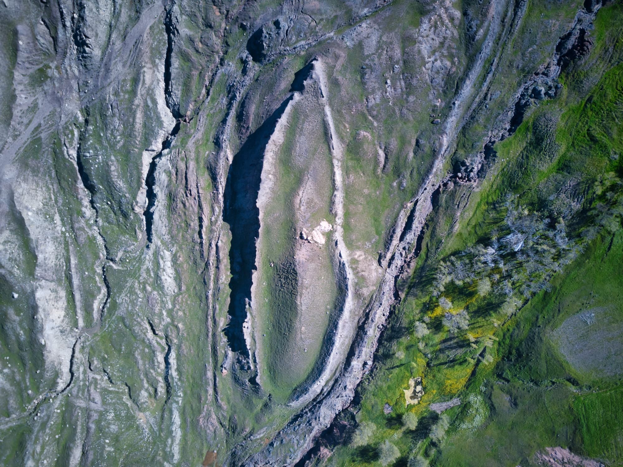
High-resolution drone imagery of the 157-meter formation, captured from multiple altitudes and angles.
DJI drone photograph of the formation, 2020.
Drone aerial view of the formation.
Aerial view of one of the many tour groups that visits Noah's ark in Agri Province.
Top of the escarpment ridge above Noah's ark.
Escarpment ridge of limestone rock above Noah's ark. Some believe the first settlement after the flood was just below this ridge.
GPR, ERT, and 3D visualizations of structures detected beneath the surface.
Ground Penetrating Radar scan at 100 MHz, showing possible tunnels (red areas) along the center of the boat and inside the southwestern hull edge.
Measurements of angular layers, northwest side of the formation
Composite GPR visualization showing detected anomalies at multiple depths.
Angular structures found 7 meters below the surface at the ark site, October 2019.
Side-view rendering of the 3D subsurface model, August 2021.
The research team on site — drilling, scanning, mapping, and meeting with local officials.
The 7th Annual Symposium on Mount Ararat & Noah's Ark held in 2023.
Ron Wyatt 1984 photo of border marker 65 along the Turkish-Iranian border.
Site of the Noah's Ark Visitor Center.
Field photos from the 2014, 2019, and 2021 expeditions to re-photograph the Wyatt 1984 "ancient inscriptions" on the Turkish-Iranian border markers.
Coordinating with local military commanders during border expeditions.
Historical photo collage of Ron Wyatt and Bill Shea documenting the border-marker inscriptions.
Ron Wyatt's 1984 visit to the border marker stele that we documented during later inscription expeditions.
Panorama of an inscription site documented during the border expeditions.
GPS tracks from the 2014, 2019, and 2021 border expeditions to markers 64–66.
Combined map of all exploration tracks across the project area, including border traverses.
Map showing the path of investigation and the locations of border markers 64, 65, and 66.
Mount Ararat itself, the surrounding region, and views from the International Space Station.
The shrinking glacier on Mount Ararat (Ağrı Dağı). No where for Noah's ark to hide up there.
Mount Ararat's summit ice cap is retreating rapidly. Prof. Dr. Faruk Kaya estimates the cap has shrunk from 70 km² to under 5 km², with projected loss of half its remaining area by 2050.
Ron Wyatt's reconstruction drawing of border "inscriptions" that he had document in the mid 1980s. They later turned out to be modern Farsi numbers.
Figure from Sarıkaya (2012, Journal of Asian Earth Sciences) mapping the Mount Ararat ice cap.
International Space Station view of the Mount Ararat region. NASA, Expedition 2.
ISS Expedition 8 view of the Mount Ararat region. NASA.
ISS Expedition 18 photograph of the Mount Ararat region. NASA.
ISS Expedition 28 large-format view of Mount Ararat and the surrounding plateau. NASA.
ISS Expedition 9 view of Mount Ararat. NASA.
ISS Expedition 53 high-resolution photograph of Mount Ararat. NASA.
Visit the site in person, or support the team capturing and analyzing these images.