What geophysical surveys have revealed beneath the surface
Has Noah's Ark been found? It is one of the most frequently asked questions in biblical archaeology, and the answer depends on how one defines “found.” In 1959, Turkish Army captain Ilhan Durupinar identified a boat-shaped formation in aerial reconnaissance photographs taken near Mount Ararat in eastern Turkey. The formation measures approximately 157 meters in length — a dimension that aligns closely with the 300-cubit measurement described in Genesis 6.
Since then, multiple research teams have investigated the site using increasingly sophisticated technology. While no excavation has yet exposed the interior of the formation, decades of geophysical data have revealed anomalies beneath the surface that are difficult to explain through natural geology alone. The question of whether Noah's Ark has truly been found continues to drive scientific inquiry at the site. Learn more about the ongoing fieldwork on our project page.
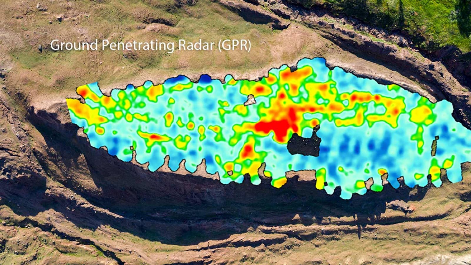
Ground Penetrating Radar scans conducted across the formation have revealed linear structures, right-angle intersections, and room-like chambers at multiple depths beneath the surface. These geometric patterns are not typical of natural geological formations and suggest the presence of a constructed object buried within the surrounding mudflow material.
Electrical Resistivity Tomography surveys have confirmed these findings by mapping conductivity anomalies that correspond to the GPR results. The subsurface readings show distinct boundaries between the interior of the formation and the surrounding terrain, consistent with a large buried structure rather than a random geological feature.
In 2024, soil analysis produced a significant finding: samples collected from inside the formation contained approximately three times more organic material than control samples taken from equivalent depths outside the formation. This elevated organic content is consistent with the presence of decayed biological material such as wood. For a deeper look at the data, visit our evidence page or read the full research reports.
At approximately seven meters below the surface, GPR imaging has identified geometric patterns that appear to represent internal compartments or chambers. These features include corridors that run the full length of the formation, with cross-members intersecting at regular intervals — a layout consistent with the structural framework of a large vessel.
The overall dimensions of the formation are particularly noteworthy. At 157 meters long, the structure corresponds closely to 300 Egyptian royal cubits, the measurement given in Genesis 6:15 for the length of Noah's Ark. The width-to-length ratio also falls within the proportions described in the biblical account.
Photographic documentation of the GPR and ERT survey results is available in our image gallery, where scan data and site photographs are presented alongside field notes from the research team.
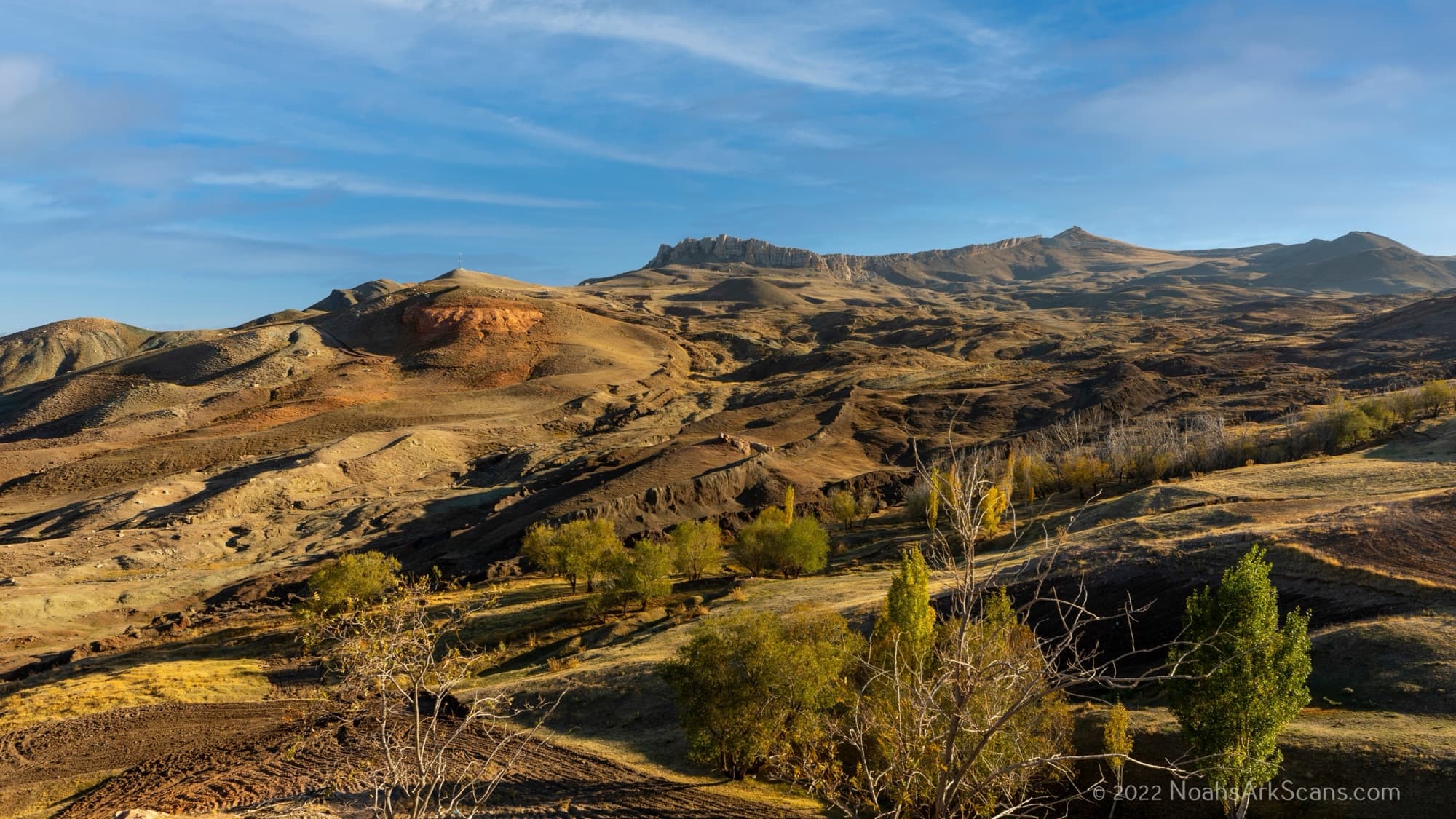
The Durupinar formation is located approximately 18 miles south of the summit of Mt. Ararat, at an elevation of roughly 6,300 feet in the foothills of the mountain range. This places the site squarely within the ancient region known as Urartu — the biblical “mountains of Ararat” referenced in Genesis 8:4, where the Ark is said to have come to rest.
The Quran also references the resting place of Noah's vessel, identifying it as “Al-Judi” in Surah 11:44, a name that local populations in the region have associated with the area surrounding the Durupinar site for generations. Both biblical and Quranic traditions point to this part of eastern Turkey as the landing area for the Ark of Noah, making it one of the most historically significant archaeological sites in the world.
The search for Noah's Ark at the Durupinar site is far from over. A Turkish-American research collaboration is currently conducting the most comprehensive geophysical survey of the formation to date, combining multiple imaging technologies to build a complete three-dimensional map of the subsurface.
Future phases of the project include targeted core drilling at locations identified by the GPR and ERT surveys, with the goal of extracting material from the anomalous chambers for laboratory analysis. If conditions allow, researchers plan to insert cameras into subsurface voids to obtain direct visual confirmation of the structures detected by remote sensing. Follow the progress on our project page.
Help fund ongoing geophysical surveys at the Durupinar site.