Geophysical surveys, soil analysis, and structural evidence
Is Noah's Ark real? It is a question that spans faith, history, and science. Rather than relying on tradition or speculation, the research program at the Durupinar formation in eastern Turkey has approached this question through empirical investigation — deploying the same geophysical tools used in professional archaeology and geological survey to examine what lies beneath a boat-shaped formation in the mountains of Ararat.
The evidence gathered over decades of fieldwork does not yet constitute definitive proof of Noah's Ark, but it presents a collection of anomalies that are difficult to reconcile with purely natural geological explanations. What follows is a summary of the key scientific findings. For a narrative account of how these discoveries unfolded, visit our Noah's Ark found page.
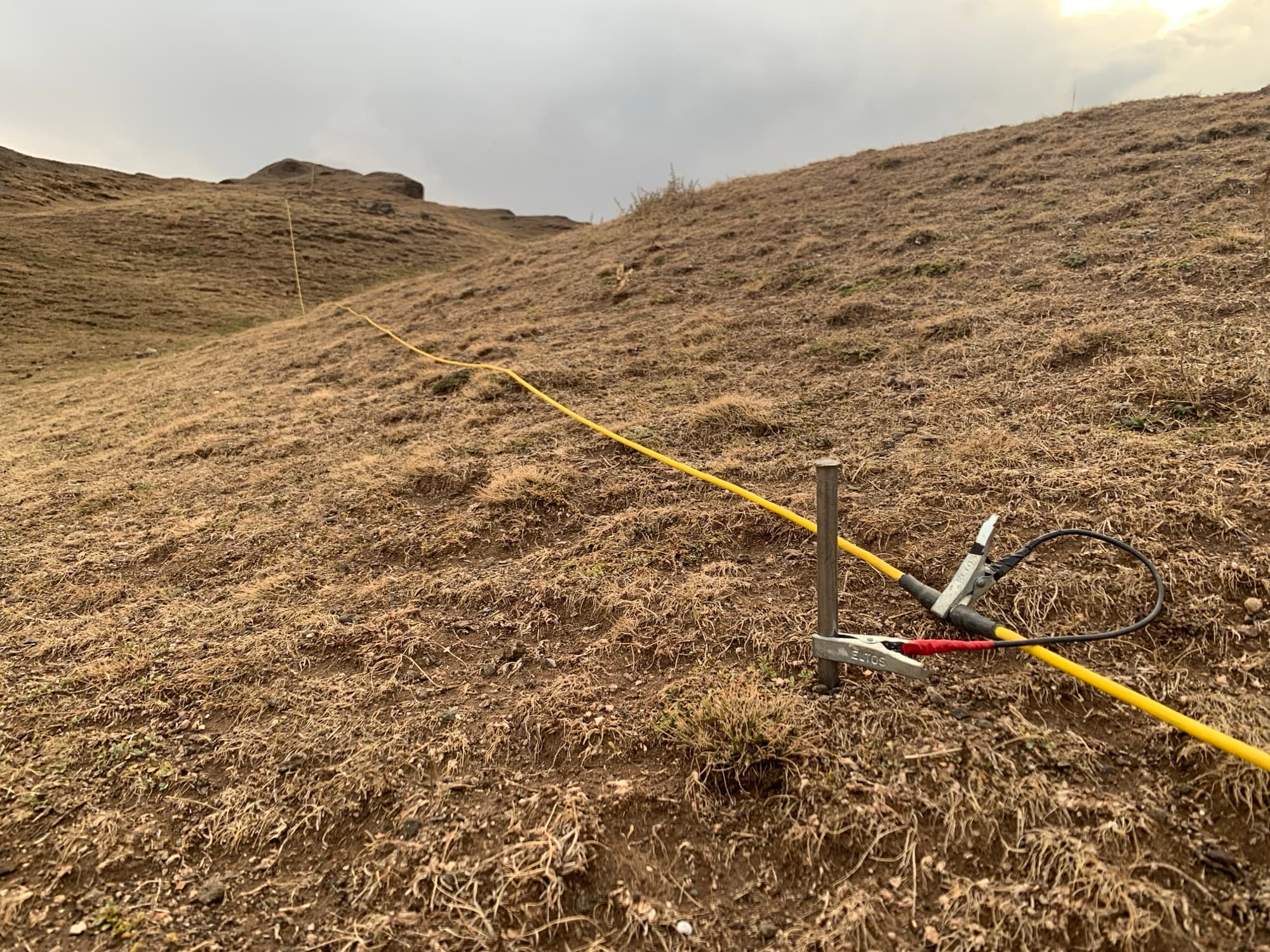
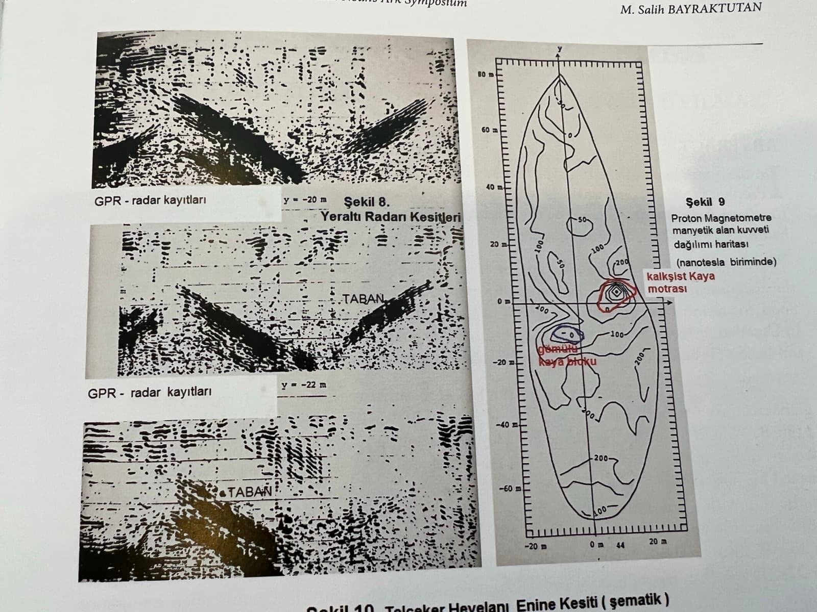
GPR scans conducted across the Durupinar formation have detected linear structures, right-angle intersections, and room-like chambers at multiple depths below the surface. These geometric features are inconsistent with the surrounding natural terrain and suggest the presence of a man-made structure buried within the mudflow material that encases the formation.
ERT surveys map the electrical conductivity of subsurface materials, revealing distinct boundaries between different material types. At the Durupinar site, ERT data shows clear conductivity anomalies that correspond to the structural features identified by GPR, reinforcing the interpretation that a large buried object is present within the formation.
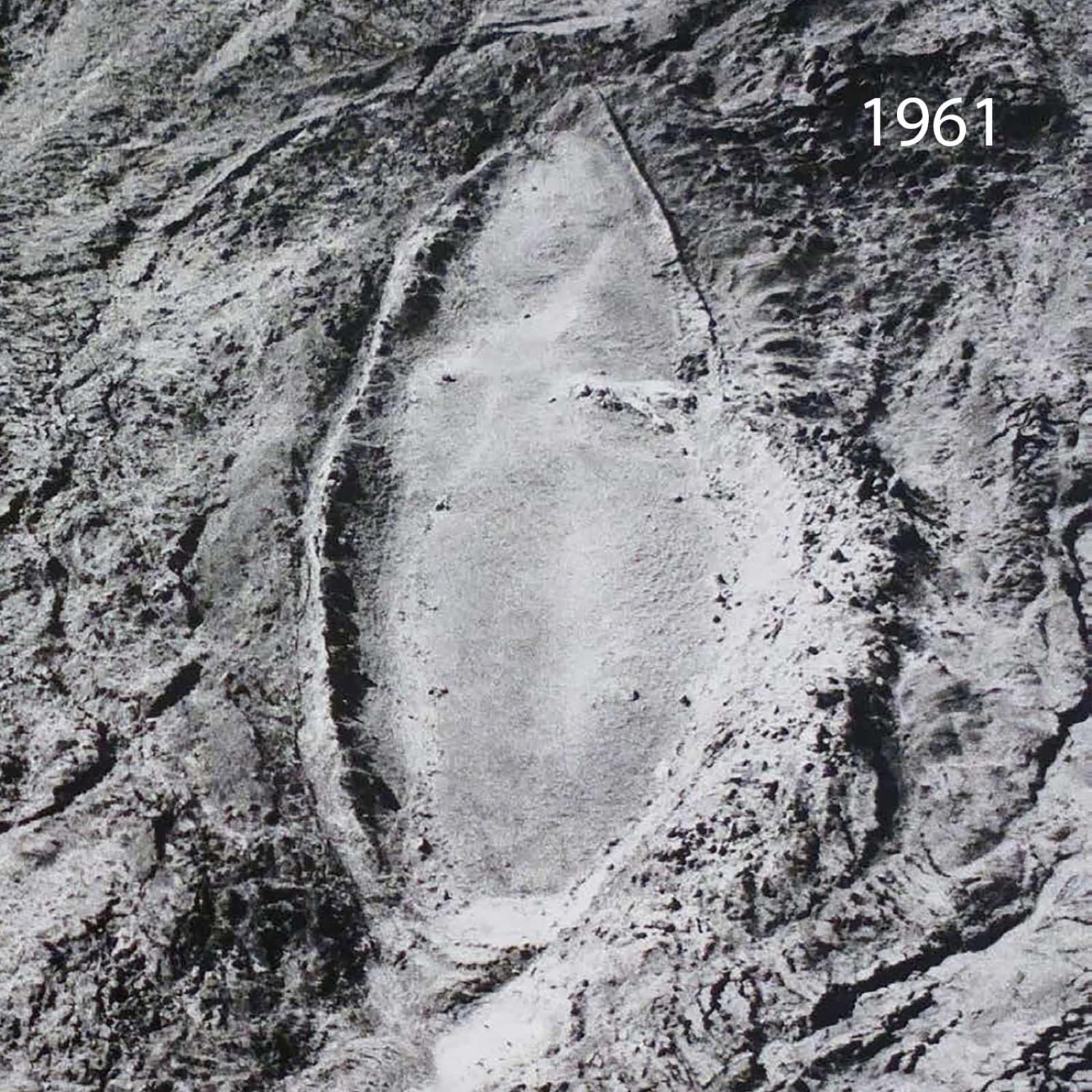
Light Detection and Ranging surveys have produced high-resolution surface topography data confirming the boat-shaped outline of the formation from above. The symmetrical shape, pointed bow, and rounded stern are clearly visible in the LiDAR data, and the proportions are consistent across multiple survey years. Detailed technical reports are available on our research page.
One of the most significant findings in the search for proof of Noah's Ark came from laboratory analysis of soil samples collected in 2024. Samples extracted from within the Durupinar formation contained approximately three times more organic material than control samples taken from equivalent depths outside the formation boundary.
This elevated concentration of organic matter is consistent with the presence of decayed biological material — potentially wood or other organic substances — within the formation. While the finding does not by itself confirm the presence of a wooden vessel, it provides measurable chemical evidence that the interior of the formation differs significantly from the surrounding natural terrain. Further isotopic and compositional analysis is planned to determine the precise nature of the organic material.
The dimensions of the Durupinar formation are central to the case for its identification as the real Noah's Ark. The formation measures 157 meters (515 feet) in length, which corresponds closely to 300 Egyptian royal cubits — the exact measurement given in Genesis 6:15 for the length of the Ark. The width-to-length proportions also fall within the range described in the biblical account.
At approximately seven meters below the surface, GPR imaging has revealed geometric subsurface patterns that appear to represent internal compartments. These include corridors running the full length of the structure and cross-members intersecting at regular intervals, consistent with the structural framework of a large vessel. Images of these scan results are available in our photo gallery.
The scientific data from the Durupinar site is complemented by a long historical record of accounts placing Noah's Ark in the mountains of Ararat. The first-century Jewish historian Josephus wrote that the remains of the Ark were still visible in his era and that people took pieces of it as relics. The Babylonian priest Berossus, writing in the 3rd century BC, recorded that local people scraped bitumen from the vessel to use as protective charms.
The Quran identifies the Ark's resting place as Al-Judi (Surah 11:44), a name that has been associated with the hills surrounding the Durupinar site by local populations for generations. Marco Polo, traveling through the region in the 13th century, described Mount Ararat and referenced the tradition of the Ark resting in its mountains. These historical accounts, spanning nearly two millennia, converge on the same geographic area where the Durupinar formation is located.
The next phase of investigation at the Durupinar formation will move from remote sensing to direct sampling. Targeted core drilling at locations identified by GPR and ERT anomalies is planned to extract material from the subsurface chambers for laboratory analysis, including radiocarbon dating and wood species identification.
If drilling confirms the presence of accessible voids, the research team plans to insert cameras into the subsurface spaces to obtain direct visual documentation of the structures detected by geophysical imaging. A comprehensive three-dimensional subsurface map is also being assembled from the combined GPR, ERT, and LiDAR data sets. Follow the progress of this work on our project page.
Help fund ongoing geophysical surveys at the Durupinar site.