In 2026, a full geological and archaeological research project was initiated at the Noah's Ark formation in the Doğubayazıt District of Ağrı Province, Türkiye. The project is directed by Prof. Dr. Cenker Atila of the Department of Archaeology at Sivas Cumhuriyet University, and is carried out in cooperation with Noah's Ark Scans.
The project has received official approval from the Erzurum Regional Directorate of the Ministry of Environment, Urbanization and Climate Change of the Republic of Türkiye. Under this authorization, a series of geological and archaeological investigations will be conducted at the site in accordance with the approved research plan — a milestone after decades of patient, non-invasive study.
Project Director
Prof. Dr. Cenker Atila
Institution
Sivas Cumhuriyet University — Dept. of Archaeology
Authorized by
Erzurum Regional Directorate, Ministry of Environment, Urbanization & Climate Change
In cooperation with
Noah’s Ark Scans
Location
Doğubayazıt District, Ağrı Province, Türkiye
Year initiated
2026

High-resolution mapping of the formation and surrounding terrain.
Continued GPR, ERT, and LiDAR imaging of the subsurface.
Studying the formation’s composition and how it came to be.
Careful, methodical research conducted under the approved plan.
Ongoing research requires specialized equipment, field personnel, technical analysis, and logistical support. Contributions from supporters help make these investigations possible.
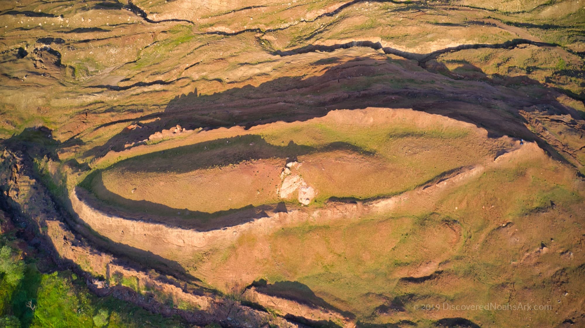
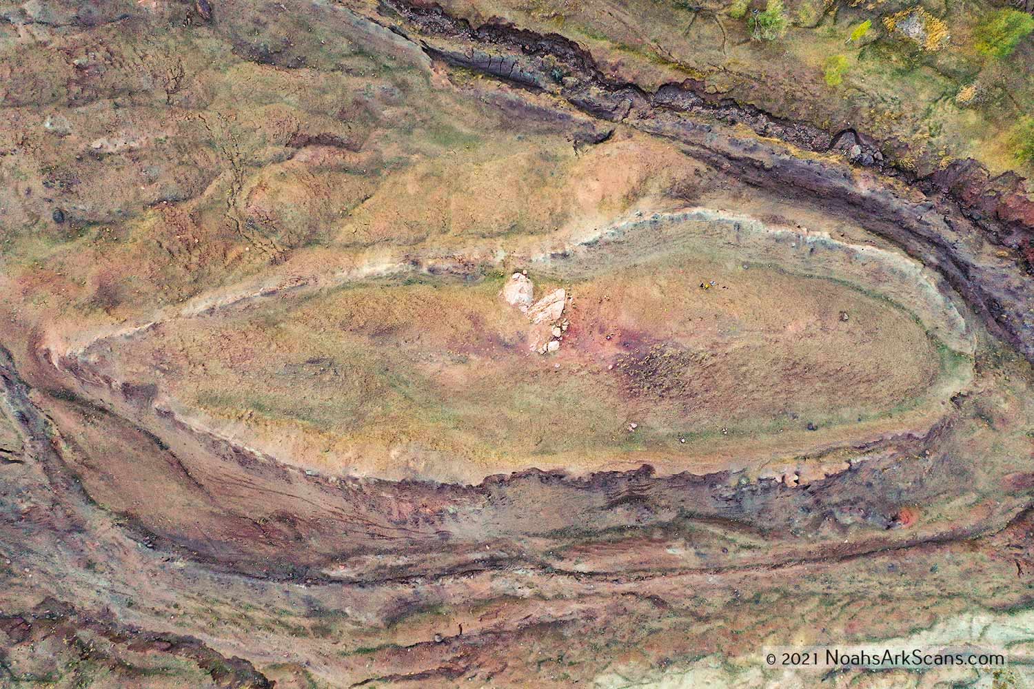
In 1959, Captain İlhan Durupınar discovered this 157-meter-long (515 feet) boat-shaped formation in aerial reconnaissance photographs of eastern Turkey near Mount Ararat. The structure perfectly matches the biblical description of Noah's Ark found in Genesis 6. Located in the mountains of Ararat, the site has been referenced in both Genesis 8:4 and the Qur'an 11:44, with the local name “Al-Judi” preserved through generations.
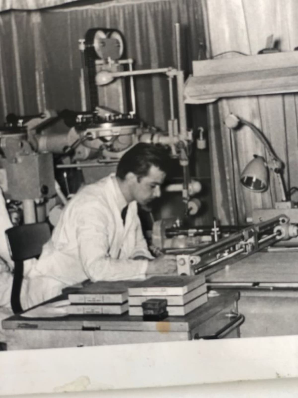
Researcher Ron Wyatt brought widespread attention to the site in the late 1970s, conducting hands-on investigations that measured the formation at approximately 300 cubits in length. In 1988, Dr. John Baumgardner and Dr. Salih Bayraktutan drilled four core holes, though only three reached significant depths. This limited sampling left much of the 515-foot formation uncharacterized.
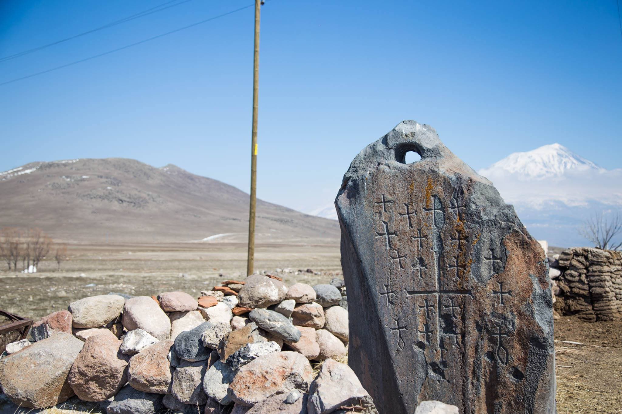
Scattered through the villages around the Durupınar site — especially at Arzap and Kazan — stand a series of enormous carved stones, some more than ten feet tall and weighing several tons. Each has a hole deliberately cut through its upper end. Researchers including Ron Wyatt identified these as drogue stones: heavy drag anchors that, in the ancient world, were trailed behind a vessel on long ropes to steady it in heavy seas and keep its bow turned into the waves.
If that interpretation is correct, these would be the drogue stones once tethered to the Ark, cut loose and left near the landing site as the waters receded. Many of the stones are carved with crosses, believed to have been added centuries later by Armenian Christians who venerated them as relics of the Flood. Skeptics offer alternative explanations — that the stones are Armenian memorial markers (khachkars) or repurposed pagan stelae — and their precise age and original purpose remain debated. Either way, the drogue stones are among the most striking features connected to the Durupınar site, and several can be visited today on our guided tours.
ERT and GPR scans conducted in 2014, 2019, and 2021 revealed unusual linear subsurface structures and right angles within the formation. A 2023 analysis uncovered corridors and room-like chambers running the full length of the structure — features that differ significantly from the surrounding natural geology.
In 2024, soil tests produced a breakthrough finding: samples collected inside the structure contained nearly three times more organic material than those from outside. Combined with GPR imaging showing geometric patterns at depths of 7 meters, the evidence suggests either a natural geological fold or a buried decayed wooden ship preserved in the mountains of Ararat (Urartu).
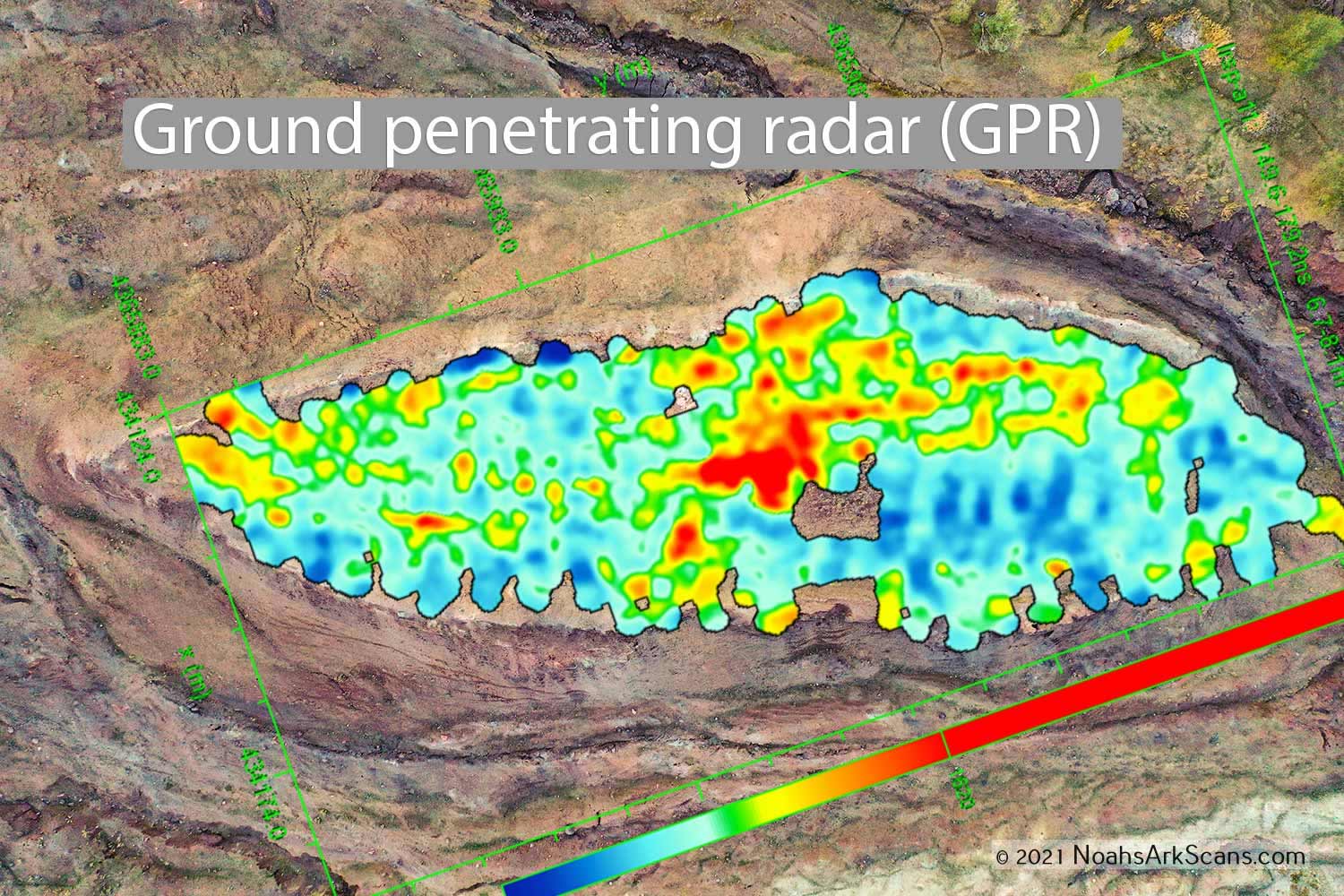
Drag to compare: 2020 aerial view vs. Ground Penetrating Radar scan overlay (right angles visible 7 m below the surface)
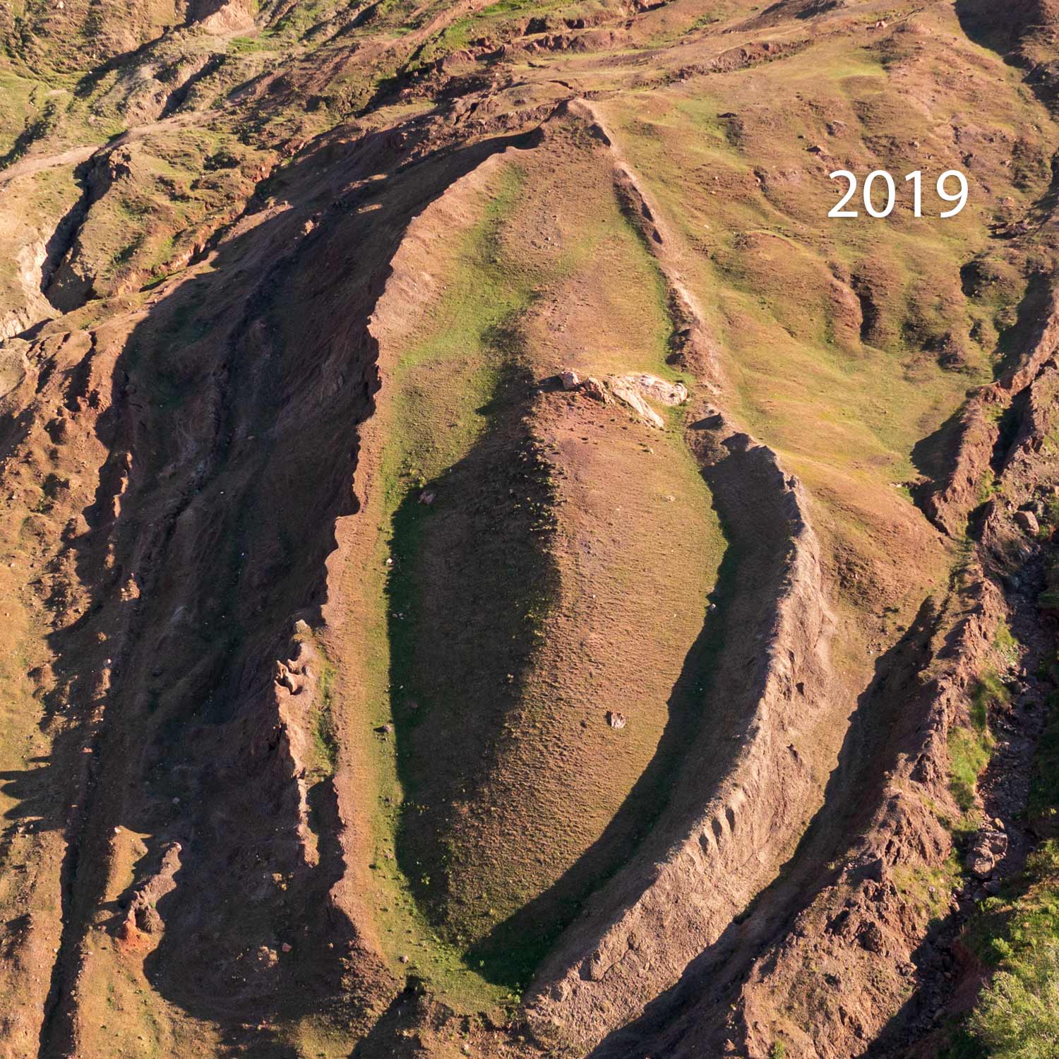
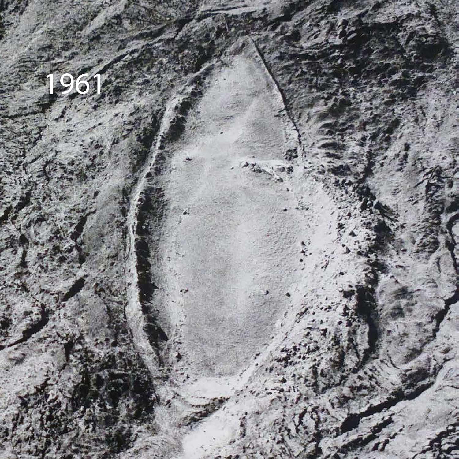
The Durupınar site: 1961 discovery photograph vs. 2019 modern drone survey
The Noah's Ark Scans team, working in collaboration with Turkish scientists and the Doubting Thomas Research Foundation, is conducting the most comprehensive geophysical survey of the Durupinar site to date. Using GPR, ERT, LiDAR, and chemical analysis, the team is building a complete subsurface map of the formation.
The 2021 Turkish Government's Scientific Project marked a major milestone. Excavations will only happen after geophysical surveys are finished and core drilling is done — a methodical approach that uses core drilling (3-4 inch diameter holes) before any destructive excavation to determine subsurface layers. Each expedition brings new data, new questions, and new insights.
Support the Ark Project through donations, tours, or sharing our content with others.